One year into the project, the collaboration between UNCCD, FAO, Aduna, Orgiis and GLOBHE already bears fruit: individual baobab trees can be now recognized from space and a computer system has been trained to plot them on a map. In the Sahel region, where trees play an important role in fixating soils, providing a barrier to land degradation and supporting food security, the baobab is particularly valued, as its fruit not only has a variety of local uses, but can also be a viable commercial export and a source of sustainable income.
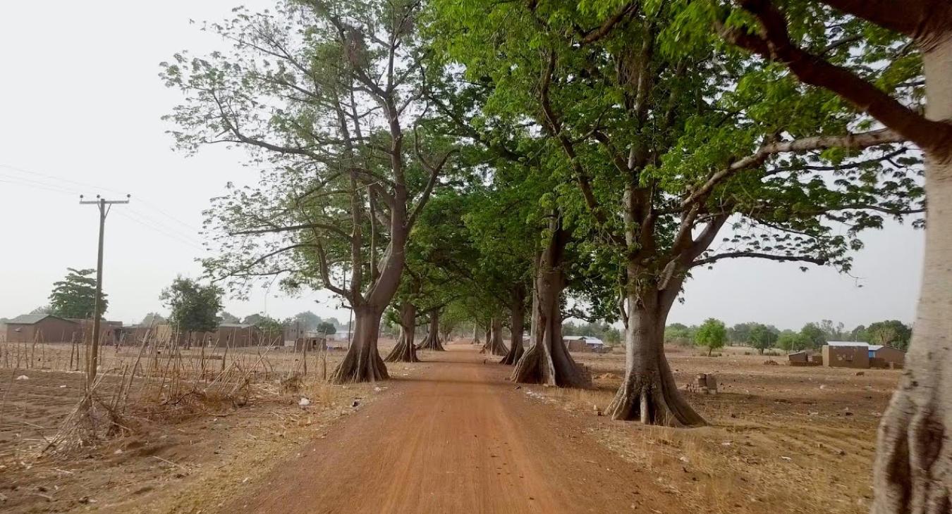
An icon of the African landscape revered as the tree of life, baobabs cannot be grown on plantations. Proudly standing big and wild, each one is unique and cherished by local communities, as it provides nourishment for people and their animals. Faced with the advance of the climate change, growing energy needs, rapid urbanization and a depleting stock of seedlings that grow to maturity, these green giants need to be carefully monitored and protected.
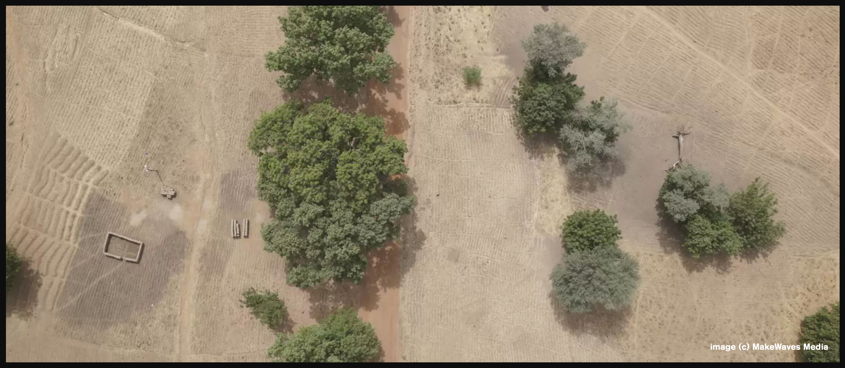
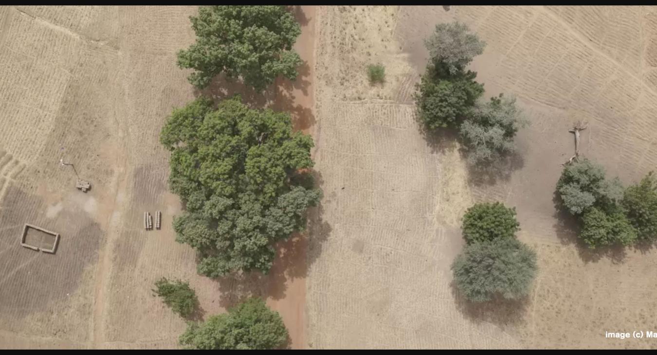
Recent advances in the spatial resolution and availability of satellite imagery have enabled the detection of individual trees from space. Using FAO’s cloud computing platform SEPAL and dense time-series approaches helps identify individual tree species through phenology, or the seasonal foliage pattern, often unique to individual species. The next challenge was pinning down the actual locations of baobab trees and “training” a classification system to extrapolate and predict the tree species associated with each tree canopy.
Drone data provided by GLOBHE at a very high spatial resolution allows identification of baobabs, and the tree locations are then combined with the phenology data to map individual baobabs over vast geographic regions. The resulting maps can be used to inform local communities of the location, number and condition of the baobabs, and enable them “to visualize and analyze high resolution satellite imagery from their mobile phones, allowing to actively monitor and protect this natural resource,” says Yelena Finegold, FAO Forestry Officer.
This collaboration between global satellite data providers, drone operators, the private enterprise, the UN and local communities, including women and youth, is a major step toward improving monitoring, conservation and restoration methods in the Sahel. As the project advances toward mapping the baobabs over larger geographical areas, it can also support the implementation of the Great Green Wall Initiative. Better understanding of where to conserve and invest in long-term sustainable use of baobabs can promote value chain development and enable better land management decisions to monitor and safeguard these green powerhouses that provide sustenance, store water and enrich the land.
image (c) MakeWaves Media
Source: UNCCD https://www.unccd.int/news-stories/stories/counting-trees-space-people-and-planet#
- Se connecter ou s'inscrire pour publier un commentaire